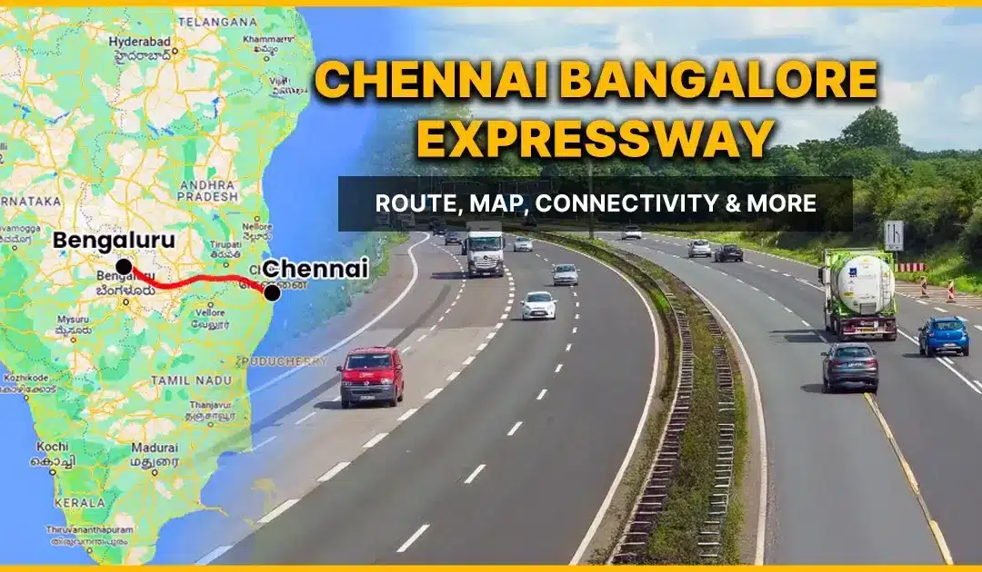
The Chennai Bangalore Expressway is among the most ambitious greenfield highway infrastructure projects undertaken in South India in recent years. The expressway will create a high-speed route that connects Chennai and Bangalore (Bengaluru) with restricted access, which will shorten travel times while improving freight operations, and driving economic and real estate growth across three states.
The National Highways Authority of India (NHAI) executed the project under the Bharatmala Pariyojana, which represents a shift from using traditional highways to modern expressway systems.
The new highway between Bangalore and Chennai will serve as a crucial transportation route, enabling industrial growth, logistics operations, and inter-city travel throughout southern India.
See also: Real Estate Investment in Bangalore: A Complete Guide
Background and Evolution of the Chennai Bangalore Expressway
The first mention of a high-speed road corridor between Chennai and Bengaluru occurred during P. Chidambaram’s Union Budget speech in 1990. The proposal experienced no progress during that period because technical, financial and administrative challenges blocked its advancement.
The project officially restarted in 2018 when the National Highways Authority of India (NHAI) began land acquisition activities. The construction work for one of South India’s biggest highway projects started in 2019. The corridor received its official designation as National Expressway 7 (NE-7) in January 2021.
See also: 10 Most Developing Areas in Bangalore: Best Investment & Living Locations
Overview of the Chennai Bangalore Expressway Project
The Chennai Bangalore Expressway is being developed as a four-lane access-controlled highway, with provisions for future expansion to eight lanes. The road network will have a speed limit of 120 kilometres per hour, which will enable it to provide better connections between the two cities than the current road systems do.
Key Project Specifications
| Parameter | Details |
| Total Length | 258 km |
| Project Cost | Approx. INR 18,000 crore |
| Start Point | Hoskote, Karnataka |
| End Point | Sriperumbudur, Tamil Nadu |
| Alternate Name | National Expressway 7 (NE-7) |
| Lanes | 4 (Expandable to 8) |
| Speed Limit | 120 km/h |
| Land Required | ~2,560 hectares |
| States Covered | Karnataka, Andhra Pradesh, Tamil Nadu |
| Project Model | Hybrid Annuity Model |
| Underpasses | 41 |
| Flyovers | 17 |
| Current Status | Partially Operational |
| Expected Completion | July 2026 |
Strategic Importance of the Bangalore to Chennai New Highway
People travel between Bengaluru and Chennai through two main routes, which include NH-48 (Golden Quadrilateral) and Old Madras Road. The new expressway will reduce this travel time to approximately 2 hours and 15 minutes, while also shortening the overall distance by nearly 80 kilometres.
The expressway directly supports the Chennai–Bengaluru Industrial Corridor, which enhances supply chain operations and enables quicker freight transport and better connectivity to ports, manufacturing areas and logistics centers.
See also: Hennur Main Road Bangalore: Real Estate Guide
Chennai Bangalore Expressway Route and Connectivity
Existing Routes vs New Alignment
Chennai and Bengaluru are linked by three primary highways, which include:
- Hosur to Krishnagiri route, which uses the Golden Quadrilateral and NH-48.
- The Old Madras Road route
- The Kolar to KGF to Vellore route
NH-48 serves as the primary highway which people use for travelling between Chennai and Bangalore because it runs for almost 380 kilometres. The Chennai Bangalore Expressway provides a better route, which takes less time and travels at greater safety because it has fewer entry points and uses modern safety features.
Chennai Bangalore Expressway Route Details
The highway system extends through three different states while it connects multiple important urban areas and vital business hubs.
Major Locations Along the Route
Karnataka:
Hoskote, Malur, Bangarapet, Kolar Gold Fields
Andhra Pradesh:
Venkatagirikota (V Kota), Palamaner, Bangarupalem, Chittoor
Tamil Nadu:
Gudiyatham, Ranipet, Arakkonam, Sriperumbudur
Chennai Bangalore Expressway Route Map
The Chennai Bangalore Expressway route map highlights a linear access control system which allows vehicles to bypass all urban areas. The interchange system provides necessary connections between different locations while maintaining high speeds of vehicle movement throughout the entire system.
Spur Roads and Auxiliary Connections
The expressway system includes spur routes, which create additional access points between the main corridor and the existing highway network.
Approved and Proposed Spur Roads
Spur 1:
The expressway stretches for 95.63 kilometres to connect with NH-4 at Dobbaspet.
Spur 2:
The route extends for 3.58 kilometres to connect with NH-4 at Konadasapura, situated to the east of Bengaluru.
Spur 3:
The route extends for 6.47 kilometres to provide access to Kolar Gold Fields.
Spur 4:
The proposed link extends for 7.44 kilometres toward Katpadi.
See also: What Is GST on Real Estate and How Does It Apply in 2026?
Project Cost and Financial Structure
The total estimated cost of the Chennai Bangalore Expressway stands at INR 18,000 crore. The allocation includes:
- The core construction part of the project receives funding of approximately INR 5,700 crore.
- The remaining budget funds land acquisition expenses, toll system costs, administrative expenses and utility relocation work.
The project execution follows the Hybrid Annuity Model, which creates a funding balance between government support and private sector investment.
Phase-Wise Construction Status
Phase 1: Karnataka (Operational)
- Length: ~71 km
- Opened: December 2024
This section includes:
- 15 major bridges
- 47 minor bridges
- 63 underpasses
- 4 toll plazas
- 1 truck lay-by
The main delay during this stage happened because workers needed to move a temple which stood on the 400-meter section of Jinnagara Circle situated in Hoskote.
Packages – Karnataka
| Package | Length | Status | Contractor |
| Hoskote – Malur | 26.4 km | Complete | Dilip Buildcon |
| Malur – Bangarapet | 27.1 km | Complete | Dilip Buildcon |
| Bangarapet – Bethamangala | 17.5 km | Complete | KCC Buildcon |
Phase 2: Andhra Pradesh & Tamil Nadu
- Length: ~85 km
- Current Progress: ~40% overall
Packages – Phase 2
| Package | Length | Progress | Contractor |
| Bethamangala – Baireddipalle | 25 km | 85.90% | Montecarlo |
| Baireddipalle – Bangarupalem | 31 km | 64.05% | APCO Infratech |
| Bangarupalem – Gudipala | 29 km | 97.04% | Dilip Buildcon |
Phase 3: Tamil Nadu
- Length: ~106.1 km
Infrastructure includes:
- 34 major bridges
- 31 minor bridges
- 3 rail overbridges
- 3 interchanges
- 3 rest areas
- 2 truck lay-bys
Packages – Phase 3
| Package | Length | Progress | Contractor |
| Gudipala – Walajapet | 24 km | 95.00% | Montecarlo |
| Walajapet – Arakkonam | 24.5 km | 95.00% | KCC Buildcon |
| Arakkonam – Kanchipuram | 25.5 km | 50.00% | DP Jain Infra |
| Kanchipuram – Sriperumbudur | 32.1 km | 70% | RCC |
The three main packages have reached almost complete work with 90% progress. The concessionaire’s financial difficulties have caused one package to experience delays.
Timeline of Key Milestones
| Year | Milestone |
| 1990s | First announced |
| 2018 | Land acquisition initiated |
| 2019 | Construction commenced |
| 2020 | 2,560 hectares acquired |
| 2021 | Contractors appointed |
| 2023 | Eight-lane provision announced |
| 2024 | The Karnataka stretch opened |
| 2026 | Expected full completion (July) |
Toll Charges on the Chennai Bangalore Expressway
Cars and Jeeps
| Trip Type | Toll (INR) |
| One-way | 185–190 |
| Same-day return | 275–280 |
| Monthly pass (50 trips) | 6,105–6,260 |
Heavy vehicles may pay a toll fee, which amounts to INR 635 for a one-way trip and INR 955 for a round trip.
The toll plazas can be found at these locations:
- Hedigenabele
- Agrahara
- Krishnarajapura
- Sundarapalya
Real Estate and Economic Impact

Sriperumbudur
- Sale prices: INR 3,500 – 5,500 per sq. ft.
- Rentals: INR 8 – 15 per sq. ft.
Hoskote & Devanahalli
The proposed cloverleaf interchange, together with its connectivity plan, will increase the need for both residential and plotted development projects.
The corridor’s ribbon development will create two major impacts, which include:
- Industrial expansion
- Employment creation
- Stable rental demand
See also: Are Gated Communities in Bangalore the Future of Urban Living?
Future Expansion Plans: Chennai Bangalore Expressway
The expressway will be expanded to Mangaluru after its construction ends, which will improve east-west transportation links throughout southern India, according to MoRTH and NHAI regulations.
Overall, the Chennai Bangalore Expressway serves as an infrastructure project which will transform South Indian transportation systems, economic development and urban expansion. The expressway will become a major transportation corridor in India because it combines fast travel with safe operation and important roadway connections.
FAQ’s
The Karnataka section, which measures approximately 71 kilometers is currently active while construction work continues on the rest of the project, which will reach its complete operational status in July 2026.
The route provides a connection between Bengaluru through Hoskote and Chennai through Sriperumbudur.
The Chennai Bangalore Expressway extends for a distance of about 258 kilometres.
The main points of entry into the area are situated at Hoskote, which is close to Bengaluru and at Sriperumbudur, which is near Chennai, together with specific interchanges that are distributed throughout the entire route.
In the Karnataka stretch, cars and jeeps must pay toll fees that begin at approximately ₹185 to ₹190 for a single journey, while larger vehicles and those using return trips or monthly passes must pay higher toll rates.